| 1823 GOVERNMENT SURVEY OF HIGHLAND |
|---|
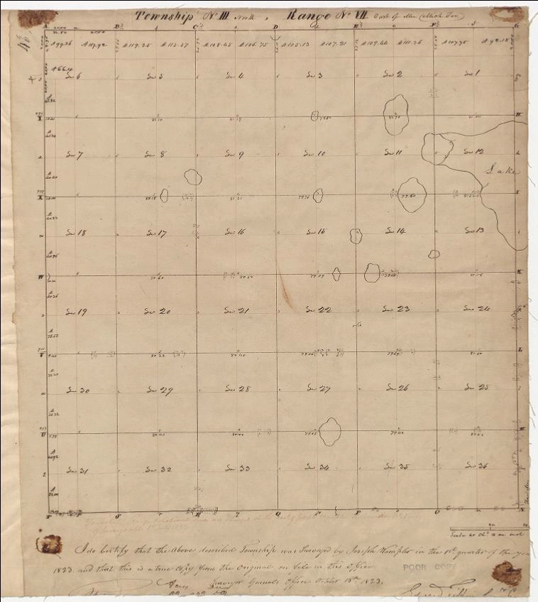
Following establishment of Michigan's baseline and meridian, teams of government surveyors were sent into the field to "lay out" and map each individual township. Among the more prominent of these surveyors was Joseph Wampler, a native of Tuscarawas County, Ohio, and said by some to have been a Methodist minister. Wampler was appointed deputy surveyor general and began work in 1816. The map below is his survey of "Township No. III North, Range No. VII East," i.e., Highland Township. It includes, at the bottom, a certification "... that the above described township was surveyed by Joseph Wampler in the 1st quarter of the year 1823..." Of interest are the outlines and size of Highland's various lakes, compared with what exist today. For example, the northwest portion of White Lake in Section 12 seems to merge with Duck Lake in Section 11. Penninsula Lake seems too far north, straddling the line between Sections 3 and 10, while Upper Pettibone Lake is too far south, on the line between Sections 10 and 15. There is likewise only a small portion of Dunham Lake shown in Sections 18 and 19.