| 1831 BURR MAP OF MICHIGAN |
|---|
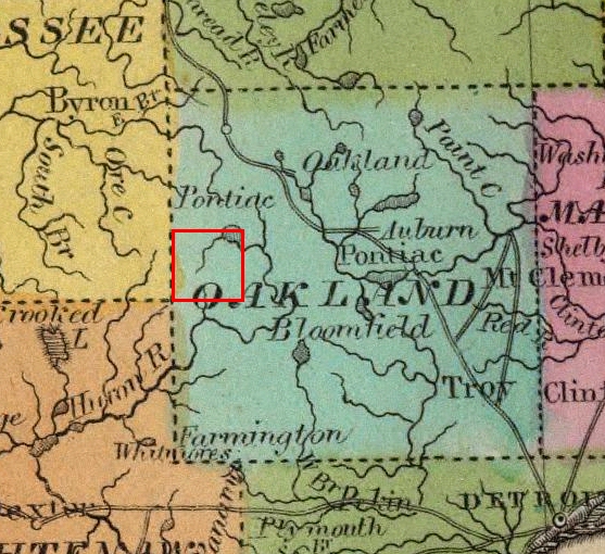
This is an enlargement of the Oakland County portion of Burr's 1831 map, with the area now comprising Highland Township outlined in red. The large lake in the upper right is undoubtedly White Lake, although its location is slightly too far north and west, and it is shown draining southeast into the Huron River. Note that at the time this map was drawn, Highland and other future townships in northwest Oakland County were still part of Pontiac Township; hence the name "Pontiac"[in italics] printed above White Lake.