| 1872 ATLAS OF OAKLAND COUNTY,
MICHIGAN MAP OF HIGHLAND CENTRE |
|---|
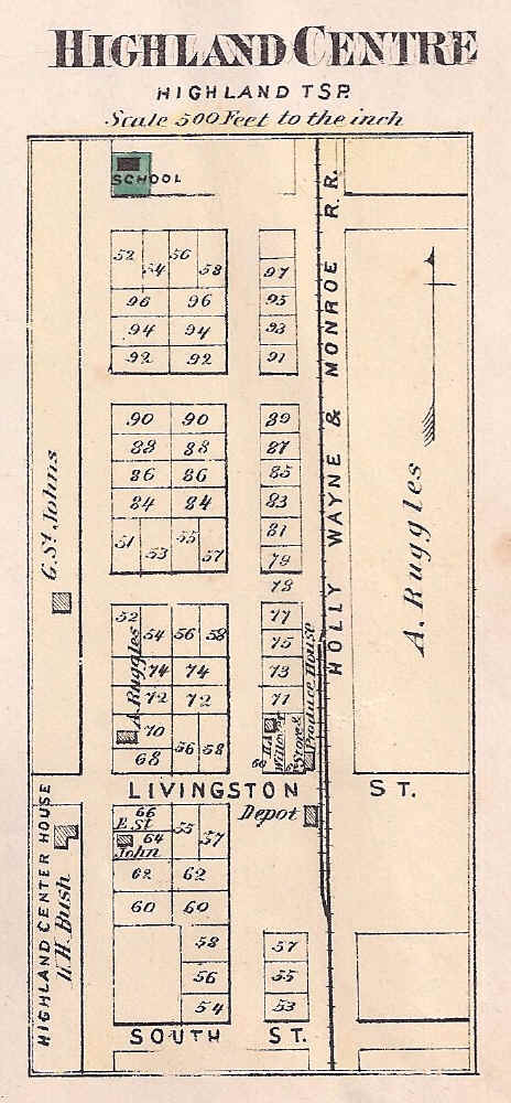
This detail map of "Highland Centre"was published in F. W. Beers & Co., Atlas of Oakland County, Michigan, (1872), p. 47, less than a year after the village was first platted. When the "Highland Station Post Office" was opened on January 1, 1874, however, the name of the village was changed accordingly. Even so, Milford Road was known as "Centre Street" well into the 1970's, while the Highland Cemetery was also called the "Highland Centre Cemetery." The school in the upper left corner is the "Union" a/k/a "Highland" School, District No. 4. Note "South Street" at the south end of town which, although platted, was never constructed.