| 1872 ATLAS OF OAKLAND COUNTY,
MICHIGAN MAP OF HIGHLAND - SPRING MILLS POST OFFICE |
|---|
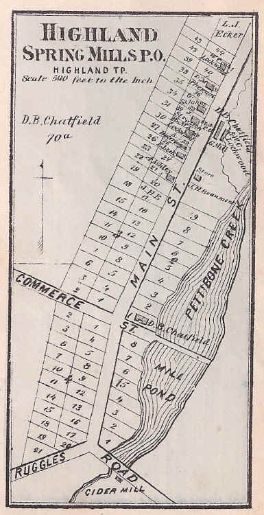
This detail map of "Highland - Spring Mills P.O." was published in F. W. Beers & Co., Atlas of Oakland County, Michigan, (1872), p. 47. Note that "Main St." is now Harvey Lake Road while "Commerce St." is Spring Mills Road (since abandoned). Ruggles Road was a short spur that branched off from East Livingston Road and headed northeast until it reached Harvey Lake Road. It then turned southeast and passed over the dam for the cider mill before rejoining East Livingston Road. When the cider mill closed in the early 1900's the need for this spur disappeared and the road was abandoned. For more on the history of this forgotten community, see the Village of Spring Mills photo tour.