| 1872 ATLAS OF OAKLAND COUNTY,
MICHIGAN MAP OF HIGHLAND POST OFFICE (WEST HIGHLAND) |
|---|
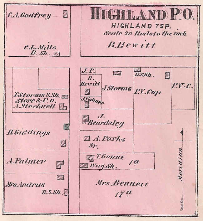
This detail map of "Highland P.O." (now the community of West Highland) was published in F. W. Beers & Co., Atlas of Oakland County, Michigan, (1872), p. 47. The east-west roadway is now M-59, while the north-south roadway is Hickory Ridge Road. Note that, in addition to its post office, West Highland once had a store, shoe shop, wagon shop and three blacksmiths. Confusion between the names of the "Highland" and "Highland Station" post offices prompted the former to be renamed "Highland Corners" in 1903. The name was changed again to "West Highland" on April 1, 1906, but this lasted only briefly as the post office was closed on October 3, 1906.