| 1873 CHAPMAN & SILAS MAP OF MICHIGAN |
|---|
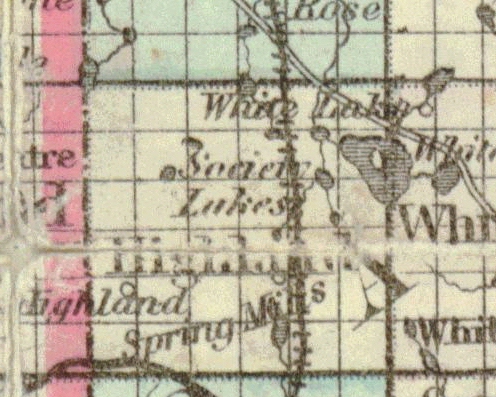
This is an enlargement of the Highland Township portion of Chapman & Silas' 1873 map. Items of interest include (i) the Flint & Pere Marquette railroad tracks, which had just been completed in 1871, and (ii) White Lake, with either Dawson's or Hubbell's Island in its center. As is the case on earlier maps, White Lake is erroneously shown draining north into Rose Township. The only road depicted is White Lake/Rose Center Road, in the northeast corner. Note the name "Society Lakes" in the middle of the township; a collective reference to the smaller lakes southwest of White Lake. What appears to be Lower Pettibone Lake is shown, but is on the wrong side of the railroad tracks.