| 1873 RAILROAD MAP |
|---|
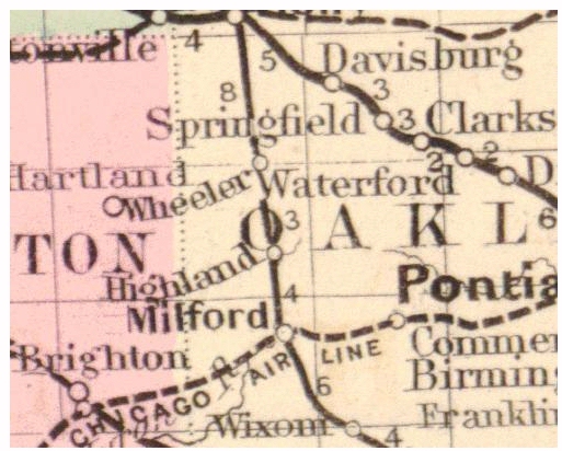
This is an enlargement of the Highland portion of Gray's 1873 New Railroad Map of Michigan. Note the station named "Wheeler," three miles north of Highland. This is the original name for the Village of Clyde. Since there was already a Wheeler in Gratiot County, however, the name was changed when the post office was established. This is only map thus far known to use the original name. As an aside, this map also shows a proposed route for the "St. Clair & Chicago Air Line" running from Pontiac, through Milford, to Jackson. This later became the Grand Trunk Western Railroad, but the actual line was constructed further south, passing through Wixom, New Hudson and South Lyon.