| HIGHLAND PLAT MAP - CIRCA 1940-45 |
|---|
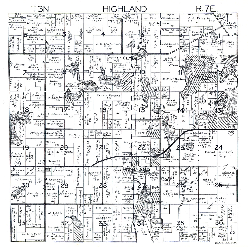
This plat map for Highland Township appears to date between 1940 and 1945. The presence of M-59 clearly puts it after 1939, since the road had been completed by then. On the other hand, Edsel B. Ford, who died in 1943, is still shown as owning the various parcels in Sections 24 and 25 which would form the nucleus of Highland State Recreation Area in the late 1940's.