| 1839 TANNER MAP OF MICHIGAN |
|---|
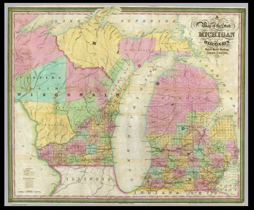
This New & Authentic Map of the State of Michigan and Territory of Wisconsin was drawn by Thomas R. Tanner and published by Henry S. Tanner, Philadephia, in 1839. "Constructed principally from the United States Surveys," it gives a much more accurate portrayal of Michigan's outline. A close look will reveal that both Genesee and Livingston counties are now shown.