| 1839 TANNER MAP OF MICHIGAN |
|---|
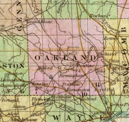
This is an enlargement of the Oakland County portion of Thomas R. Tanner's 1839 map. While the townships themselves are not named, the lines of all of Oakland County's twenty-five townships are shown, with Highland containing the "O" in the name "OAKLAND." White Lake is again visible, as are the two Indian "Paths" noted on Henry S. Tanner's 1833 map. A new feature is the dashed line running east-west through the middle of Oakland County, including the southern portion of Highland Township. This was the proposed route of the ill-fated Clinton-Kalamazoo Canal; a 216 mile waterway across the entire Lower Peninsula from Mt. Clemens, on the Clinton River, to Saugatuck, on the Kalamazoo River. Construction began at Mt. Clemens in 1838, but was beset by financial difficulties and competition from Michigan's growing railroad system. By the time the project was abandoned in 1846 only 12 miles of the canal had been completed, reaching as far as Rochester, Michigan. For more on the Clinton-Kalamazoo Canal, click here.