| 1840 GREENLEAF MAP OF MICHIGAN |
|---|
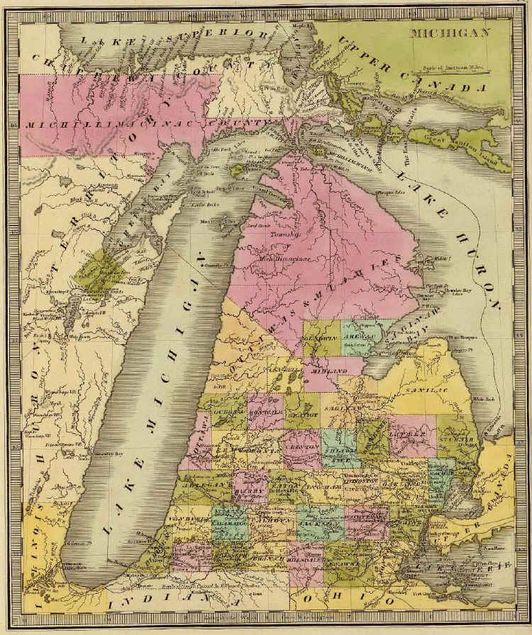
This map of Michigan was published in 1840 by Jeremiah Greenleaf in A New Universal Atlas; Comprising Separate Maps Of all the Principal Empires, Kingdoms & States Throughout the World: and forming a distinct Atlas Of The United States, printed by G. R. French, Brattleboro, Vermont. Although purporting to be "Carefully Compiled from the best Authorities Extant," it retains the distorted view of the Lake Michigan shore found on earlier maps, even though a more accurate depiction was published by Thomas R. Tanner the year before.