| 1909 USGS TOPOGRAPHIC MAP |
|---|
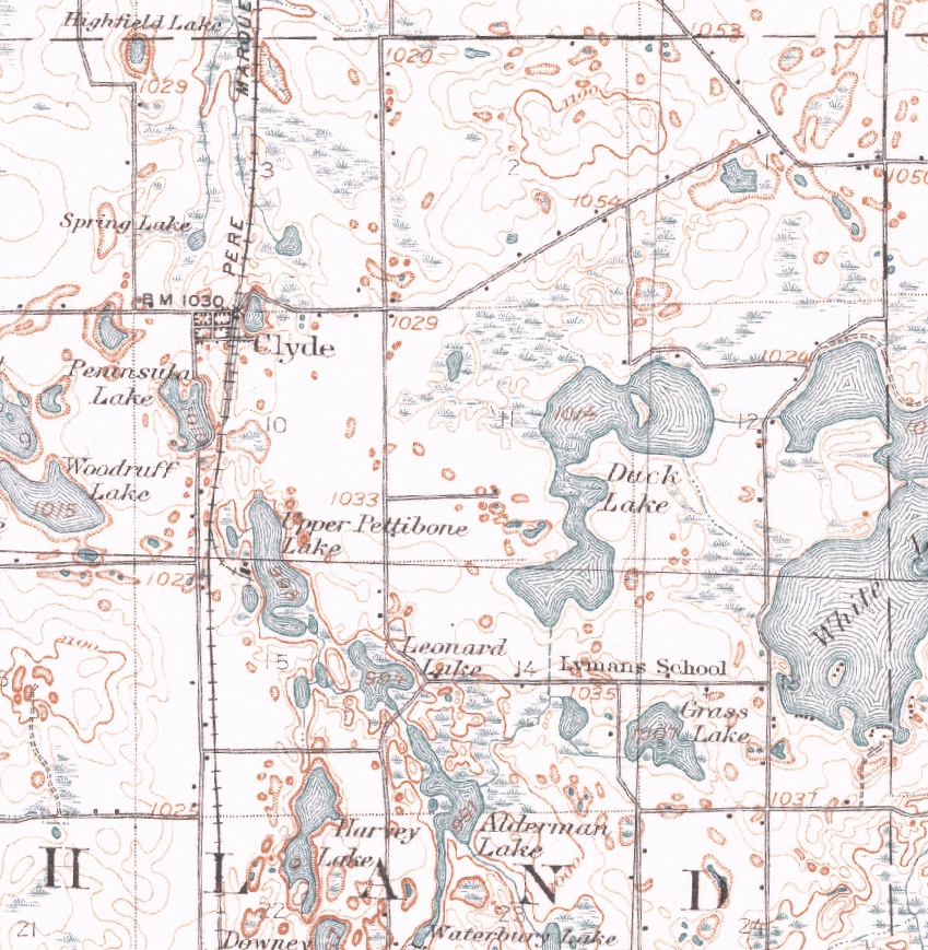
This enlargement of the 1909 USGS Topographic map shows the northeast portion of Highland Township (Sections 1, 2, 3, 10, 11, 12, 13, 14 and 15). Items of interest include, but are not limited to (i) "Spring Lake" in Section 3, now part of Knoblock Lake; (ii) "Highfield Lake" in Section 3; the only map thus far found giving this small lake a name; (iii) the configuration of the railroad's main line and sidings in Clyde; (iv) the dashed line in Section 12 representing the drain between White and Duck Lakes; (v) the Lyman School in Section 13; (vi) the dashed line in Section 14 representing the drain of Duck Lake; and (vii) the ice houses and workers dormitory on Upper Pettibone Lake, along with the rail siding that once served them, in Section 15.