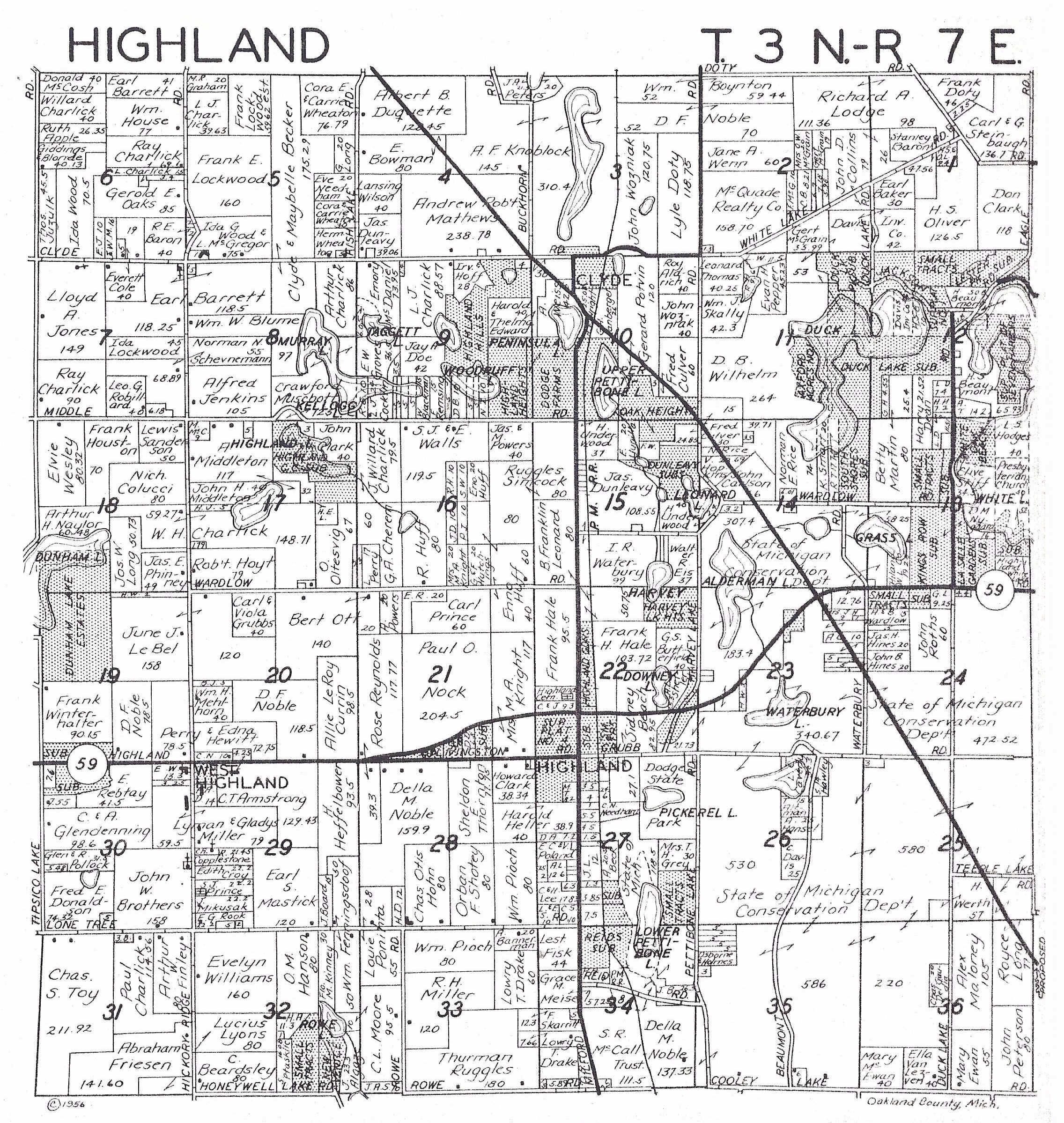
| HIGHLAND PLAT MAP - 1956 |
|---|
This plat map for Highland Township dates from 1956. The black line running diagonally through sections 4, 10, 14, 23, 24 and 25 was the proposed route for the Northwestern Highway Extension. While shown on various maps for many decades, this proposed highway was never constructed.